
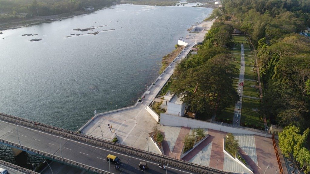
Across India, riverfront development has increasingly become a familiar model of urban development. A river is often treated as an opportunity to create promenades, parks, recreational spaces and new public amenities along the water. But perhaps the more fundamental question is: what should a riverfront mean for a city?
A river is not simply an edge waiting to be developed. It is part of the city's ecology, hydrology, history and everyday life. Its relationship with the city is different in every place, and therefore the public space created around it cannot follow a single template. For some cities, the river may be a major civic space. For others, it may be an ecological corridor, a cultural landscape, a working waterfront or an important part of the city's water system. In many places, the river also has a strong relationship with agriculture, fishing, informal activities or religious practices. This raises an important question: should every riverfront look and function the same?
Our work around the Daman Ganga at Pipariya made us look at this question differently. Instead of beginning with what could be built along the river, the more relevant starting point was to understand what role the river already plays in the city and how public space could strengthen that relationship.
A riverfront does not necessarily need to be a continuous promenade. It could be a series of smaller public spaces connected to the river. It could be an ecological landscape that allows people to experience the water while retaining its natural functions. It could be a recreational space, a cultural gathering place or a working edge. In some locations, the priority may be to accommodate seasonal flooding and protect the river's ecological systems rather than maximise access to the water. The appropriate response will depend on the river and the city. A riverfront in a dense metropolitan city will have different requirements from one in a smaller town. A perennial river will behave differently from a seasonal one. A river with strong cultural associations requires a different approach from one that primarily functions as an ecological or agricultural system.
The challenge for urban planning is therefore not simply to make rivers more accessible. It is to understand what kind of relationship between the river and the city is appropriate in each context.
This understanding then needs to translate into a practical planning framework. The first step is to identify the most suitable model of development for the specific river and its urban context, rather than adopting a predetermined riverfront typology.
The next question is how that model can be realised. This requires exploring different design and financing options, considering the scale of investment, the role of public and private stakeholders, and the long-term operation and maintenance of the proposed public spaces and infrastructure.
Finally, detailed planning needs to identify the potential and challenges of implementation. Land ownership, existing settlements, environmental constraints, flooding, infrastructure capacity, access and governance can all significantly influence what is feasible.
Looking at these issues early can help ensure that the riverfront is not only a good design proposal, but a project that can actually be implemented and sustained over time. Perhaps the success of a riverfront should not be measured by how much of the river edge has been paved, landscaped or made accessible. Maybe the future of riverfront planning lies not in designing more riverfronts, but in understanding what each riverfront should mean for its city.